


Openreach joins UK gov’s infra tracking project
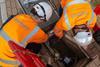
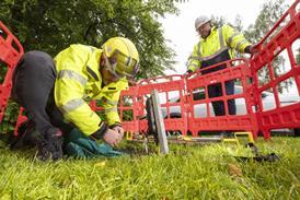
Openreach joins the UK government’s National Underground Assets Register, highlighting the potential to reduce accidental damage to its infra and improve rollout efficiency for other businesses by mapping out its network through the scheme…
This article includes:
- Organisations: CityFibre; Openreach; Ordnance Survey; UK government; Virgin Media O2 (VM O2).
- Geographies: Europe; United Kingdom (UK).
- People: Trevor Linney; Carsten Roensdorf; Tom Stabb.
- Themes: Accidental damage prevention; Asset database; Broadband infrastructure; Civil team safety; Communications service providers (CSP); Consolidated infrastructure map; Electricity infrastructure; Employee safety; Gas infrastructure; Gigabit-capable networks; Infra deployment acceleration; Infra maintenance efficiency; Infra rollout efficiency; Infrastructure mapping; Location data sharing; Minimum viable products (MVP); National infrastructure map; Network cabinets; Network chambers; Network conduits; Network ducts; Network poles; Network spans; Pipeline infrastructure; Underground assets; Utilities; Water infrastructure.
Register for free to continue reading this article
Join the TelcoTitans community and continue reading this article
By registering for a free account, you will get immediate access to the rest of this article, plus:
- Enhanced access to TelcoTitans with several article views per month
- TelcoTitans weekly newsletter
“The detail is very good. Better than we get internally.” – GM, Vodafone OpCo
Want full access to TelcoTitans content? Check out our subscription options.